Physiography of Southern Indiana
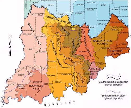 The sedimentary rocks laid down in the Paleozoic were subjected to erosional processes during the subsequent, Cenozoic Era. The generally humid climate of southern Indiana contributed greatly to these processes. Shales and sandstones are more impervious to erosion, so the areas where they outcrop tended to form uplands with deeply incised drainage valleys. Where limestones were exposed, much of it was dissolved and removed. Rivers became deeply entrenched, creating enough hydostratic head to encourage karst formation in these areas. At the boundaries between the stratigraphic layers, east-facing bluffs or escarpments formed (see map). The Springville Escarpment continues to retreat westward, leaving behind outliers -- sandstone capped remnants of the original uplands. All of these physiographic units extend well into present-day Kentucky.
A significant karst area also developed in the Devonian/ Silurian limestones of north-central and eastern Indiana. Present-day remnants of this karst topography may be seen in portions of the Muscatatuck Plateau; however, they lack the development of the central karst due to the few deeply incised master streams in this region.